Land Based Sustainable Aquaculture Strategy - Part 8
11/ Elevation and topography
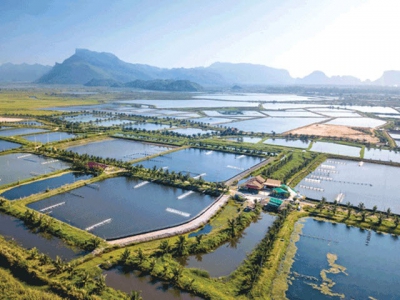
PREFERRED LOCATION
Ponds using estuarine or marine waters on a site with an elevation above 1 metre Australian Height Datum (AHD) and a slope of less than 2%.
A site for freshwater ponds that has a slope of less than 5%.
Key elevation and topographic considerations include:
- coastal land below 1 metre AHD is likely to have significant ASS issues. Ponds constructed on these sites are likely to have problems with draining and drying and ASS. Tidal and flooding inundation is likely to occur on land below 1 metre AHD. These sites are also at greater risk from sea level rise;
- land above 2 metres AHD is less likely to contain ASS; the slope of the land will influence the shape of the ponds, drainage system and construction cost.
Topography is an important issue for high security species with translocation concerns. It is also an important factor if pond discharge water is to be used onsite for irrigated crops. I&I NSW Agnote DPI-493, “Landform and soil requirements for biosolids and effluent reuse” (I&I NSW 2004) contains further information on landform assessment and requirements for effluent reuse.
Soil and soil contamination
A site that:
- has clay loam or a soil/sand mix with low erosion potential;
- has no soil contamination from previous land uses;
- has no ASS; or ASS landform Process Class A with Landform Element class b, l, t, p, y or w;
- is suitable for freshwater recycle systems/irrigated agriculture.
The soil characteristics of a site can influence construction costs and the long term maintenance and management costs. With high security species, particularly those with translocation concerns, the assessment of suitability of the soil for pond or dam construction is essential.
Key soil considerations include:
- sites which have clay or clay loam soil characteristics suitable for pond construction (stable and nil seepage). A soil survey is recommended covering the pond construction site and at the estimated pond excavation depth to determine if there are likely to be any gravel or sand layers, rock strata and other soils characteristics that may interfere with water holding qualities and thus add to the construction costs. Soil specialists at the Land and Property Management Authority and/or DECCW may have soil survey information or maps of particular sites. If saline water is used the risk of seepage is high even in clay soils as the saline water can cause the clays to flocculate and increase permeability;
- for sites with highly dispersive or flocculative soils, additional erosion controls and other measures (dam liners) to prevent dam wall failure through ‘tunnelling’ may need to be factored into the costs;
- land previously used for crops, should be tested for accumulated pesticide residues such as organophosphate, carbamates and synthetic pyrethroids. Current pesticide and herbicide use on adjoining lands and within the catchment need to be investigated to ensure minimal impact on site;
- in estuarine areas, high-risk acid sulfate soils (ASS) should be avoided. ASS can impact on aquaculture operation through poor water quality, acid runoff and costly remediation. Sulfidic muds also have poor load bearing characteristics resulting in pond wall instability and leakages. Soil survey work will be required to identify the depth to the ASS and any likely ‘hot spot’ areas, particularly as ASS may not be evenly distributed across a site. Reference should be made to the ASS Manual for sampling and assessment regimes;
- with some soils the preloading of the site prior to construction may need to be considered to ensure stability. However, consideration of the effects of compaction on groundwater levels and the potential for discharge of acid is required.
Tip!
ASS risks maps (available from DECCW) are a useful tool for ruling out unsuitable aquaculture sites. Sites on ASS should be evaluated using methods in the ASS Manual.
Irrigation Soils
The characteristics of the receiving soils for irrigation need to be thoroughly investigated to ensure they are suitable to receive such waters into the future without creating environmental or management issues.
Tip!
If irrigation is proposed using recycled water or processing wastewater, the suitability of the soil for pasture, crops or tree plantations must be considered. Factors such as fertility, permeability and slope should be considered when assessing methods of irrigation and crop types. All relevant soil characteristics should be fully established when designing an irrigation system. NSW DPI Agnote DPI -493 , Landform and soil requirements for biosolids and effluent reuse (NSW DPI 2004) and the DECCW Environmental Guidelines: Use of Effluent by Irrigation contains further information on landform assessment and requirements for effluent reuse.
Related news
 Land Based Sustainable Aquaculture Strategy - Part 5
 The following is an overview of the issues that need to be considered when determining whether a proposed site would have a reliable water supply
 Land Based Sustainable Aquaculture Strategy - Part 6
 A water licence or activity approval is required to install a pump, construct a levee, divert the river flow, undertake works within 40 metres of a river
 Land Based Sustainable Aquaculture Strategy - Part 7
 A pond aquaculture site not located in areas of high groundwater (within 3 metres of the surface), or areas highly vulnerable to groundwater contamination